Short Answer
Cambridge Channel is a narrow marine passage that cuts through the heart of Franz Josef Land, the high‑Arctic archipelago in the Barents Sea. The channel runs roughly north‑south, separating a string of modest islands that form part of the central cluster of the archipelago. Ice dominates the waterway for most of the year, with only brief summer openings when the surrounding sea ice retreats.
The waterway was first documented by the Austro‑Hungarian North Pole Expedition under Julius von Payer and Karl Weyprecht, who sighted and roughly charted it during their discovery voyages of 1873–1874. Subsequent British expeditions, notably the Jackson–Harmsworth Expedition (1894‑1897), refined its position and gave the channel its enduring name in honour of the University of Cambridge, a patron of polar science.
Today Cambridge Channel lies within the protected boundaries of the Russian Arctic National Park and remains a reference point for modern scientific cruises that study sea‑ice dynamics, marine biodiversity, and climate change in the high north.
Location
Cambridge Channel is situated in the central sector of Franz Josef Land, between the islands of Kuhn Island (to the west) and Cambridge Island (to the east). The approximate centre of the channel is at 81°30′ N latitude and 55° E longitude. Administratively it belongs to Arkhangelsk Oblast and is managed as part of the Russian Arctic National Park.
Map
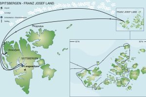
The channel first appeared on Payer’s 1874–75 map of the newly discovered archipelago, labelled “Cambridge Channel” in English and “Proliv Cambridge” on later Russian charts. Leigh Smith’s 1880 sketch maps reproduced the feature with a more accurate outline, while the Jackson–Harmsworth Expedition produced a detailed hydrographic chart in 1896 that established its true dimensions. Soviet‑era Admiralty charts of the 1930s solidified the modern spelling and added depth soundings. Modern satellite‑derived maps show the channel as a narrow, ice‑filled trough extending roughly 15 km from north to south.
Geography
The channel is approximately 15 km long and varies between 2 km and 5 km in width. Its banks are low, composed of eroded marine sediments and occasional basaltic outcrops that reflect the archipelago’s Jurassic–Cretaceous bedrock. The water depth ranges from 30 m in the centre to less than 10 m near the shorelines, where shallow shoals and submerged ridges are common.
Glaciers and Ice Cover
Cambridge Channel is flanked by the outlet glaciers of the surrounding ice domes, most notably the Kuhn Ice Dome to the west. Ice cover exceeds 90 % of the year; only in late July and early August does a narrow lead of open water appear, driven by the seasonal melt of the adjacent glaciers.
Geology
The islands bordering the channel consist of marine sandstones and shales of Late Jurassic to Early Cretaceous age, interspersed with basaltic dykes and dolerite sills that intruded during the Cretaceous volcanic phase. Fossiliferous layers containing ammonites and marine reptiles have been reported on the western shore, indicating a former shallow‑sea environment.
Wildlife
Despite the persistent ice, the channel supports a modest assemblage of Arctic fauna. Polar bears (Ursus maritimus) use the ice floes as hunting platforms, while walruses (Odobenus rosmarus) haul out on the low‑lying coastal rocks during the brief ice‑free period. Seabird colonies of Brünnich’s guillemots (Uria lomvia) and ivory gulls (Pagophila eburnea) nest on the steep cliffs that fringe the channel. The surrounding waters are frequented by bowhead (Balaena mysticetus) and beluga whales (Delphinapterus leucas), which follow the seasonal retreat of the sea ice.
Exploration History
The Austro‑Hungarian North Pole Expedition (1872‑1874) first sighted the waterway while navigating the central archipelago aboard the steam‑schooner Tegetthoff. In their 1873 journal, Weyprecht noted a “narrow sea‑passage of considerable depth” separating two unnamed islands, which Payer later named Cambridge Channel on his 1875 map.1
British explorer Frederick George Jackson, leading the Jackson–Harmsworth Expedition (1894‑1897), entered the channel in August 1895, establishing a temporary depot on its eastern bank. Jackson’s detailed surveys produced the first accurate depth soundings and confirmed the channel’s north‑south orientation.
During the early 20th century, the channel was used as a navigational route by several Russian scientific voyages, including the 1900 expedition of Eduard Toll aboard the Zarya. In 1932, the Soviet icebreaker Malysh traversed the channel en route to the newly founded polar station on nearby Tikhaya Bay.
Historic Sites
Remnants of the Jackson depot survive as a weather‑worn stone cairn on the eastern shore, still visible on modern aerial photographs. A small wooden cross, erected by the Austro‑Hungarian crew in 1873, lies on the western bank, though only the foundation stones remain.
Scientific Research
Since the 1990s, the channel has been a focal point for sea‑ice and oceanographic studies conducted by the Russian Arctic and Antarctic Research Institute (AARI) and international partners. Seasonal ice‑profiling campaigns measure thickness, salinity, and temperature gradients, while satellite altimetry tracks the annual extent of the ice‑free lead.
Name Origin
The name “Cambridge Channel” honors the University of Cambridge, which supplied scientific instruments and expertise to the Austro‑Hungarian expedition. Russian charts retain the transliterated form “Proliv Cambridge”. No later Soviet renamings have altered the designation.
Neighboring Islands and Straits
To the west of Cambridge Channel lies Kuhn Island, a low, glaciated landmass rising to 250 m above sea level. Eastward, Cambridge Island (Ostrov Cambridga) reaches 300 m and hosts the small wildlife observation point known as Cape Cambridge. North of the channel, the narrow strait of Zhuravlev Passage connects to the larger Arctic Ocean, while to the south the channel opens into the shallow Tikhaya Bay.
FAQ
Why is it called Cambridge Channel?
The channel was named by the Austro‑Hungarian North Pole Expedition in honour of the University of Cambridge, which provided scientific support for the voyage.
Is Cambridge Channel navigable today?
It is ice‑filled for most of the year; only a brief summer lead may allow small ice‑strengthened vessels to pass, and navigation is generally limited to research icebreakers.
What wildlife uses the channel?
Polar bears hunt on the ice, walruses haul out on the rocky shores, and seabirds such as Brünnich’s guillemots nest on the cliffs; bowhead and beluga whales frequent the surrounding waters during the melt season.
Leave a Reply